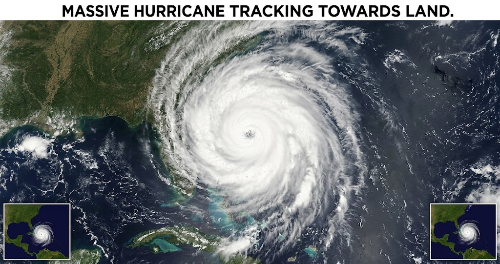
A hurricane can change coastal communities within hours, bringing powerful winds, dangerous flooding, and widespread power outages. Understanding how these storms develop and how forecasters track them can help you make safer decisions before severe weather arrives. This guide explains hurricane categories, warning systems, preparation steps, and reliable ways to follow storm updates across the United States.
What Is a Hurricane?
A hurricane is a rotating tropical cyclone that forms over warm tropical or subtropical ocean waters. It develops around a low-pressure center and draws energy from warm ocean water, moisture, and atmospheric conditions that support organized thunderstorms. In the Atlantic and northeastern Pacific, a tropical cyclone becomes a hurricane when its maximum sustained winds reach at least 74 miles per hour.
Hurricanes can affect coastal areas and communities far inland. Their impacts include destructive winds, storm surge, heavy rainfall, flash flooding, and occasionally tornadoes. Therefore, people should assess local hazards rather than judge a storm by its category alone.
The same type of storm has different names in other parts of the world. Meteorologists generally use the term typhoon in the northwestern Pacific, while hurricane describes these systems in the Atlantic and certain other ocean regions. The National Oceanic and Atmospheric Administration explains how tropical cyclones form and receive their classifications.
How Does a Hurricane Form?

Hurricane formation requires favorable environmental conditions. Warm ocean water supplies heat and moisture, while moist air rises and creates thunderstorms around an area of low pressure. As air moves toward this center, Earth’s rotation helps the developing system organize and spin.
However, warm water alone does not guarantee hurricane formation. The atmosphere must also support sustained thunderstorms, sufficient moisture, and relatively low vertical wind shear. Strong wind shear can disrupt the storm’s circulation and prevent it from strengthening.
As the system organizes, forecasters may classify it first as a tropical depression and then as a tropical storm. Once sustained winds reach hurricane strength, meteorologists assign a category based on wind speed. The storm may intensify, weaken, or change direction as it interacts with the ocean and atmosphere.
Hurricane Categories Explained
The Saffir-Simpson Hurricane Wind Scale classifies hurricanes into five categories according to maximum sustained wind speed. Higher categories indicate stronger winds and greater potential for wind damage. However, the scale does not measure storm surge, rainfall totals, inland flooding, or tornado risk.
Here is how the five hurricane categories compare under the standard US wind scale.
| Category | Sustained Wind Speed | General Wind Damage Potential |
|---|---|---|
| Category 1 | 74–95 mph | Some roof, siding, and tree damage |
| Category 2 | 96–110 mph | Considerable damage to roofs and vegetation |
| Category 3 | 111–129 mph | Major structural damage is possible |
| Category 4 | 130–156 mph | Severe structural and roof damage is possible |
| Category 5 | 157 mph or higher | Catastrophic wind damage is possible |
The key takeaway is that even a Category 1 hurricane can threaten lives and property. A weaker storm may produce dangerous flooding, while a stronger storm can create devastating wind damage. Always follow local warnings and evacuation instructions instead of relying only on a category number.
Hurricane Season in the United States
Hurricane season varies by ocean basin. In the Atlantic, including the Caribbean Sea and Gulf of Mexico, the official season runs from June 1 through November 30. The Eastern Pacific season begins on May 15 and also ends on November 30.
These dates describe the official seasons, not a guarantee that storms will occur only during those months. Tropical cyclones can sometimes develop outside the usual period. Consequently, residents in vulnerable regions should understand their local risks throughout the year.
The Atlantic season can affect Florida, Texas, Louisiana, the Carolinas, and other coastal states. Nevertheless, hurricane impacts can extend beyond the coastline through heavy rainfall, river flooding, and damaging winds. Inland residents should also monitor forecasts when a storm approaches.
For readers who want to learn more about regional conditions, [internal link suggestion: US hurricane season forecast and regional weather updates] can connect this article to a related weather guide on your website.
Hurricane Tracker How to Follow Storm Updates
A hurricane tracker helps readers monitor a storm’s location, projected path, wind speed, and expected movement. Official forecast maps can show the probable direction of travel, while advisory updates provide information about changing hazards.
For US storms, the National Hurricane Center is a primary source for official tropical cyclone forecasts, watches, and warnings. Its website also provides storm discussions and information about potential impacts. Check the National Hurricane Center’s official forecast and preparedness resources rather than relying on unverified social media posts.
Forecast maps require careful interpretation. A forecast cone represents uncertainty about the future location of a storm’s center; it does not show the full area that could experience dangerous weather. Damaging winds, heavy rainfall, and coastal flooding can extend well beyond that cone.
Meanwhile, local National Weather Service offices and emergency management agencies provide location-specific alerts. Check updates regularly because the expected track, intensity, and timing may change as new observations become available.
Hurricane Watches and Warnings
Hurricane watches and warnings communicate different levels of risk. A hurricane watch means hurricane conditions are possible in the specified area, while a hurricane warning means those conditions are expected. The National Hurricane Center generally issues these alerts using a 48-hour watch window and a 36-hour warning window for hurricane conditions.
Storm surge alerts are separate and deserve equal attention. A storm surge watch indicates a possibility of life-threatening coastal flooding, while a storm surge warning signals a danger of such flooding. Follow the instructions accompanying each alert because the timing and local risks can differ.
Residents should never wait for a hurricane warning before preparing to leave an evacuation zone. Local authorities may issue evacuation orders earlier to allow people enough time to travel safely. If officials direct you to evacuate, follow their guidance promptly.
Hurricane Preparedness How to Protect Your Family

Preparation works best when it starts before a storm threatens your area. Review your local evacuation routes, identify a safe place to stay, and understand whether your home faces coastal flooding or other hazards. Make a communication plan so family members know how to reconnect if mobile networks fail.
Keep essential supplies available, including drinking water, nonperishable food, medications, a first-aid kit, flashlights, batteries, and a battery-powered or hand-crank radio. Store important documents in a waterproof container and charge phones and backup batteries before conditions deteriorate. Also, plan for children, older adults, people with disabilities, and pets who may need additional assistance.
If you live in a hurricane-prone area, inspect windows, doors, roof conditions, and nearby trees before the season begins. Secure outdoor furniture and other loose objects when a storm approaches. Avoid using candles when possible because they can create fire hazards during power outages.
You can find more detailed guidance in the National Oceanic and Atmospheric Administration’s hurricane safety guide. For another relevant article on your website, consider adding an internal link to a guide about [emergency kits for severe weather].
What to Do During and After a Hurricane
When a hurricane threatens your location, follow official alerts and remain in a sturdy shelter away from windows. Move to a designated safe area inside the building if winds become severe. Do not go outdoors to inspect damage during a lull, because the eye of the storm may pass before dangerous winds return.
Floodwater presents a serious danger during and after a storm. Never walk or drive through flooded roads because the water may hide debris, damaged pavement, or powerful currents. If authorities issue an evacuation order, use the recommended route and avoid shortcuts through flooded areas.
After the storm passes, wait for local officials to confirm that it is safe to leave shelter or return home. Downed power lines, unstable structures, contaminated water, and damaged roads can remain hazardous. Use generators outdoors and away from windows to prevent carbon monoxide poisoning.
Power may remain unavailable for an extended period in severely affected areas. Therefore, conserve phone battery life, rely on official recovery updates, and avoid unnecessary travel while emergency crews clear roads and restore essential services.
Conclusion
A hurricane can create dangerous conditions far beyond its center, making reliable forecasts and early preparation essential. Understanding hurricane categories, tracking official advisories, and recognizing flooding risks can help you protect your household and make informed decisions.
Before the next storm threatens your area, review your emergency plan and save the National Hurricane Center’s website for updates. Stay informed, follow local safety instructions, and share reliable preparedness information with your family.
FAQs
What is the difference between a hurricane and a tropical storm?
The main difference is sustained wind speed. A tropical storm has maximum sustained winds of 39 to 73 mph, while a hurricane reaches at least 74 mph. Both systems can produce heavy rainfall, flooding, dangerous surf, and damaging winds, so a tropical storm should never be considered harmless.
When is hurricane season in the United States?
The Atlantic hurricane season officially runs from June 1 through November 30. The Eastern Pacific season starts on May 15 and ends on November 30. However, tropical cyclones can form outside these dates, so residents in exposed areas should understand their risks and monitor official weather information.
What is the most dangerous part of a hurricane?
The greatest danger depends on location and storm conditions. Storm surge can cause life-threatening coastal flooding, while inland rainfall can trigger flash floods and rising rivers. Strong winds can also damage buildings and create flying debris. Follow local hazard warnings instead of assuming one part of a storm is always the most dangerous.
How accurate is a hurricane tracker?
Hurricane trackers use observations, computer models, and meteorological analysis to estimate a storm’s future path and intensity. Forecasts generally become less certain farther into the future, and the projected center does not represent the full area at risk. Check updated official advisories and local alerts as conditions change.
How can I prepare for a hurricane at home?
Create an emergency plan, identify evacuation routes, and keep essential supplies ready before hurricane season. Secure outdoor objects, protect important documents, and make arrangements for pets or family members who need assistance. During a threat, follow official warnings and evacuate promptly if local authorities instruct you to leave.
For more updates visit: PUBLIC TALK